
The greater Prescott area is growing by leaps and bounds. New home construction can be found throughout the tri-city area. Prescott, Prescott Valley, Chino, Dewey, & Mayer are all growing.
Hey, that sounds larger than a tri-city area. Correct, but for some reason folks often mention the Tri-city area here, even though we’ve got a few more towns that are tied into the area!
With new projects like Deep Well, Pronghorn Ranch, and Granville’s expansion there are a lot of new homes being built. And apparently the demand is there. And honestly, we all love Prescott and all of the amazing scenery, recreation, historic sites, and more. So is it any wonder more people are looking to move here? No wonder at all.
Google can’t even keep up with the growth here!
If you’ve ever pulled up a Google Map on your smart phone you know sometimes information is missing. Google Maps can only do so much to keep up with new construction, new roads, changed roads, and more. And with the ongoing growth in the Prescott area, Google Maps will take some time to catch up with all of the changes. Fortunately, there are ways to keep up with all of these construction projects, new roads, and new neighborhoods. Drone services can help fill in the blanks.
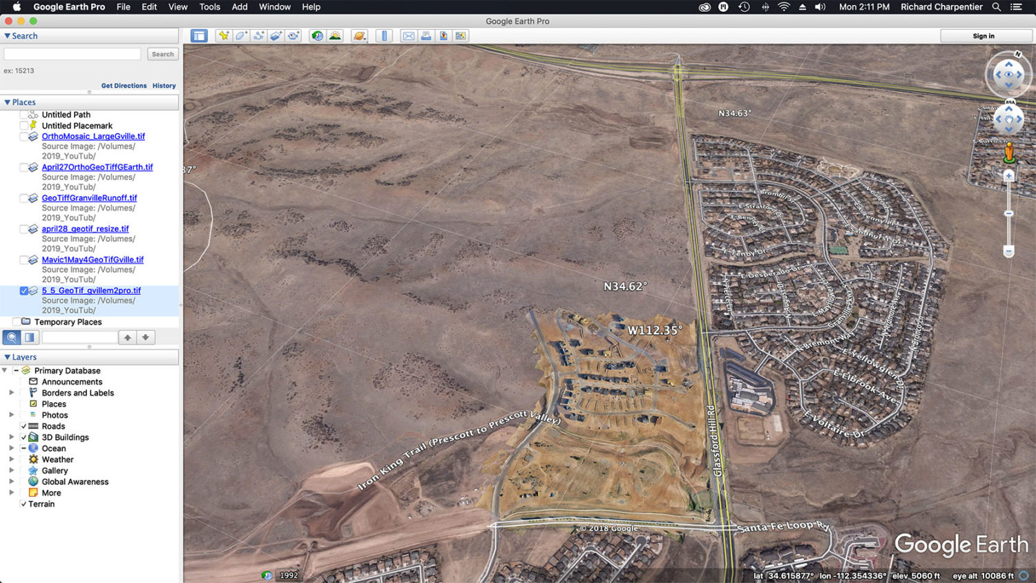
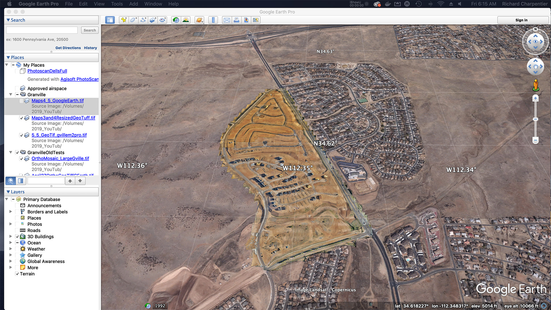
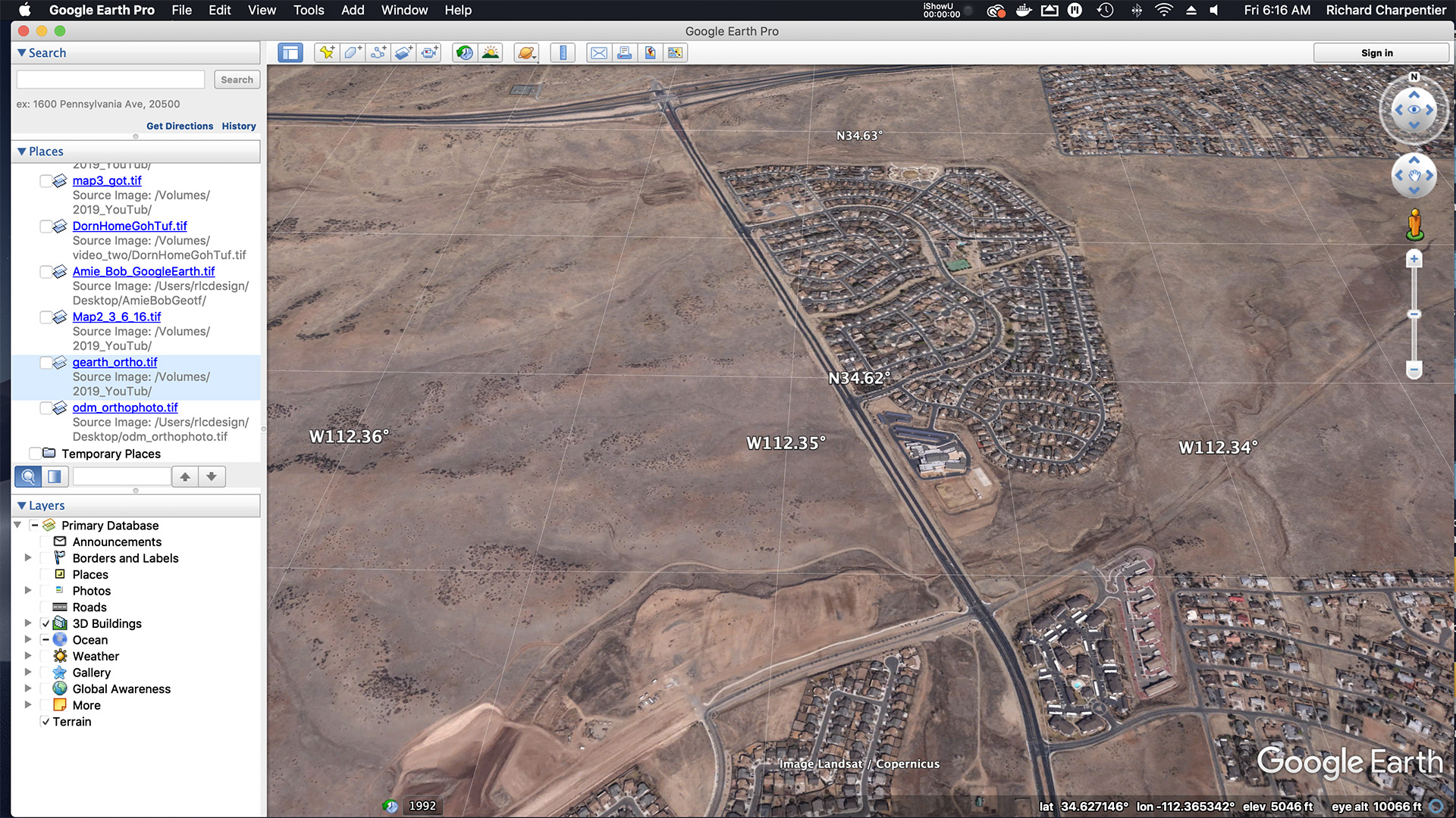
The image below is actually 2 images. There’s a slider in the middle of the image, so give it a try. You’ll notice some changes as you move the slide from left to right and right to left. What is it you’re seeing here? Simply put, you’re seeing a screen capture of Google Earth and the new Granville construction area. Nearly 100 acres of new construction has been added to the map with a drone Orthomosaic overlay. Google Earth hasn’t been updated with the latest images of the area, but with a drone we can easily overlay an entirely new construction location with custom drone maps.
Prescott Drone Models From AZ Drone
It’s often difficult to really visualize a construction project from the ground. For resident, prospective residents, construction companies & their sub-contractors, the final product is often hard to imagine. But with regular drone flights and progression reports, visualizing new communities, homes, commercial spaces, and more, become very easy to imagine. That’s because you can see it all with well developed drone models.
If you need to regularly see the progress of your construction project, and you’d like to see that progress in real time, consider working with AZ Drone. We can help you visualize your job project on a daily, weekly, or monthly basis. They say a picture is worth a thousand words, and we believe when you see these types of images of your job sites the value be worth even more than that to you. Stay up to date with construction progression, flag problem areas early, and more. Contact us today to learn more.