
Construction Services
Drones on your job site
AZ Drone looks to provide the best quality of imaging and aerial data collection with today’s cutting edge drone technologies. Utilizing aerial imaging and data we can help construction companies manage their resources more effectively, make decisions with more accurate data, track site progress more easily, provide methods to share progress with investors and customers alike, add to workplace safety, and save money throughout the process. The drone revolution is just beginning, and all organizations involved in the construction industry will benefit from the latest in aerial data collection.
Interactive 3D Modeling
This sample 3D drone model was not imaged at a high resolution, yet still provides a very realistic view for a client we've been working with on a gated community build. This is a prime example of what we provide.
*Hit play then click, drag and scroll the model*
Drone 3D Modeling
A flat print map of your construction site is one thing. But with the latest 3D modeling technologies you can take it even further. Whether you’re looking to overlay current progress with blueprints initially provided at the start of your project, or you’re looking for volumetric measurements, aerial imaging and data capture can help you achieve your goals.
Seeing a project develop via 3D modeling can help provide investors with near real time information that demonstrates a site’s progress and current needs.
3D point clouds are generated from overlapped geo-referenced images giving you the accurate location in the object space. 3D models are highly dependent on the number of images provided and their overlap. The bottom line is simple. The more data captured in the field, the more realistic and usable the 3D models become. How accurate you'd like to be depends on your specific per project needs.
Monitor Your Construction Sites As They Evolve!
By utilizing georeferenced orthophotos and 3D data you and your investors will see exactly where your project is at.
View the current state of your site for up-to-date information and continued analysis, making on the ground management and virtual inspections more efficient.
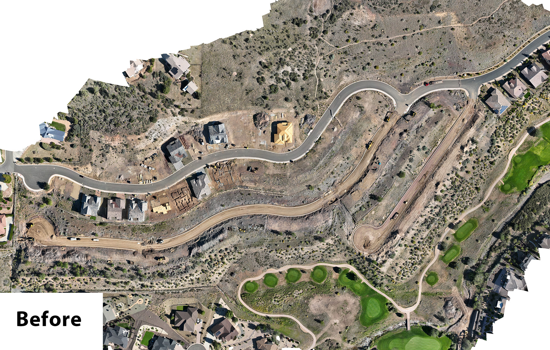
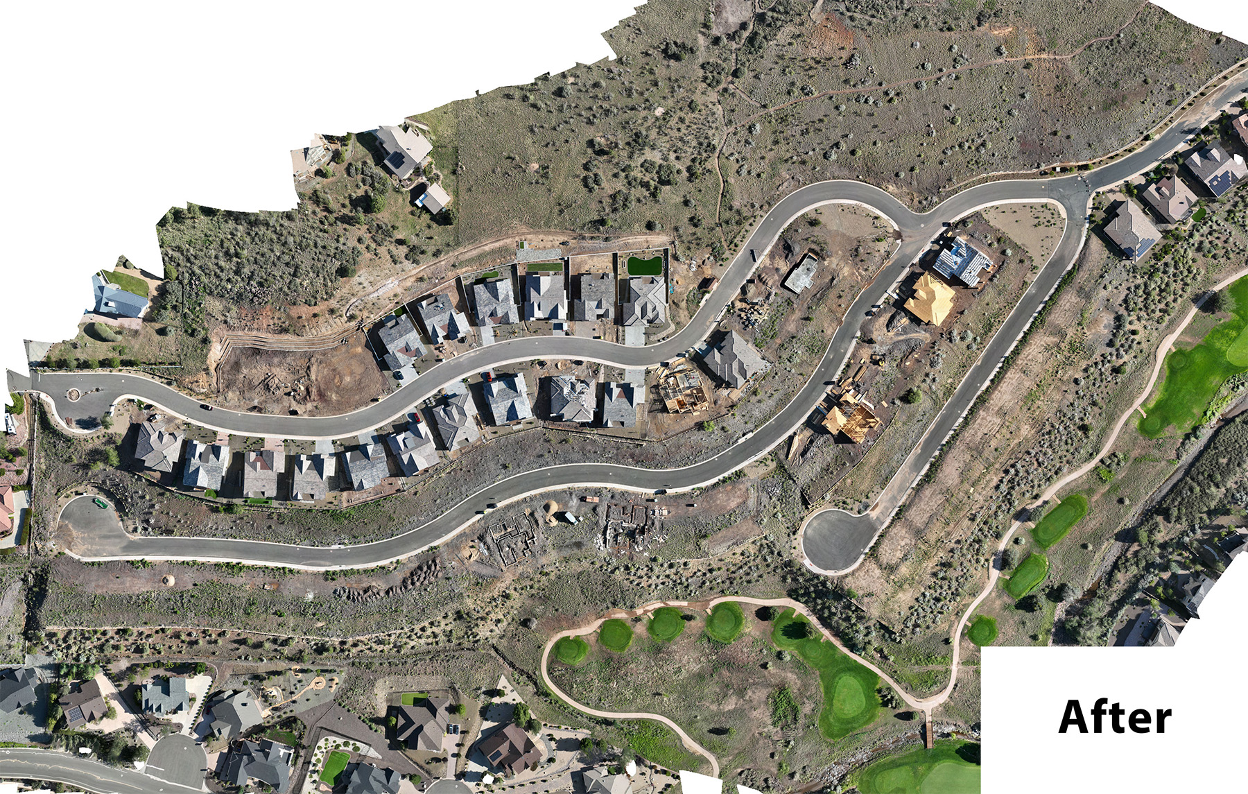
Take a closer look at a 2D model. (if nothing's there reload the page)
Click and drag the slider bar in the middle to see the changes. This particular model is using images that were shot 6+ months apart. Utilizing a preplanned and repeatable route allows for such before & after images to be easily captured.
Construction Progression Video
Drone Construction Progression
If you’re starting a new construction project from the ground up, drone imaging and data capture can help you demonstrate site progress over time. Whether a few times a week, or once a month, aerial video, stills, and data points can be gathered from set locations to demonstrate whether or not your project is on time and on budget or not. Developing a catalogue of your projects and their progression will also add to your ability to market your construction firm to other similar projects by demonstrating your workplace management and attention to timelines and time constraints.
On the left is a video put together from a horse ranch construction project near Skull Valley, Arizona. The second item is a 2D map of a construction site with a month to month "before and after".
Drone Site Modeling
Whether you’re at the beginning of a new construction project, or finishing out your latest masterpiece community, AZ Drone can assist with aerial modeling of your project. Aerial modeling can showcase your construction location, workplace progress, site features, and more. Investors and buyers alike can get a bird’s eye view of the overall location from start to finish, or they can get a finalized view of the project’s completion.
Drone based data collection for site modeling provides much more detail than a Google Map or Google Earth map. Seeing a site with detail on this level can be a compelling marketing feature, and can also be useful in planning development as a project is under way. Measurements, acreage, and volumetric measurements are all possible with properly selected targets before any flight begins! Of course, only a licensed land surveyor can interpret measurment data to ensure accuracy and compliance with the region you're building in. AZ Drone will happily supply all collected data to your survey team and work directly with them for specific data collection needs.
With quality information provided through drone modeling you can save both time and money relaying your project to any interested parties, while increasing workplace safety as well.
A Sample Drone Model
Below is an example of a drone modeling project for one of our clients. This is a map of an RV Park in Tucson, AZ and how we can overlay the model into Google.
Click the Layers icon in the top right corner to check/uncheck boxes for the different views available, including a digital elevation model.