Construction Progression from AZ Drone - Prescott Arizona
Based out of Prescott Arizona, AZ Drone is positioned to assist home builders and their subcontractors in the Greater Prescott area with their ongoing projects.
Before breaking ground on a new project site, through to the completion of new homes and communities, we're here to help you visualize and track your construction projects.
Whether you want to track progress daily, weekly, or monthly, AZ Drone offers a variety of options to assist builders with monitoring their overall construction site progress.
Below you'll find examples of the types of deliverables we offer to our construction clients.
- Video Time Lapse - Day to day, week to week, month to month. However you'd like to view construction progress, we can assist you.
- 360 Degree Interactive Images
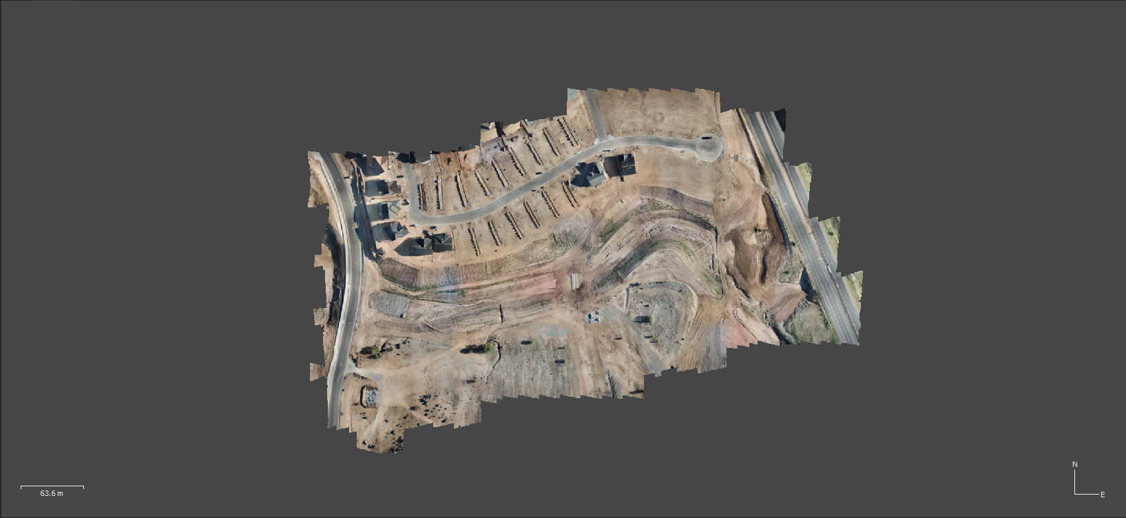
- Orthomosaic 2D Models
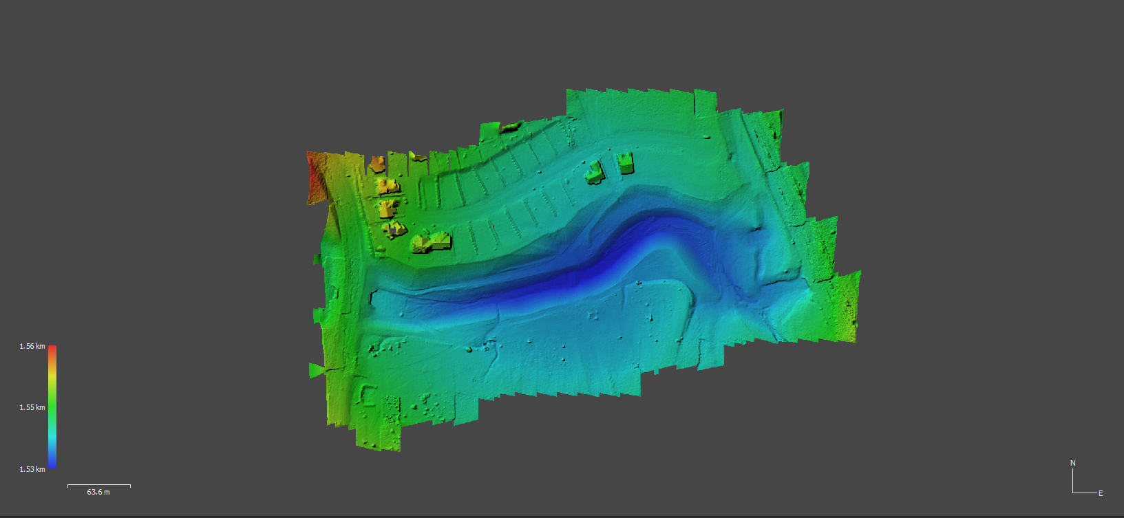
- DEM (Digital Elevation Modeling)
- 3D Interactive Models
Drones are capable of doing more than just helping to make a pretty listing for real estate agents. Truth be told, drones have a place from the start of a new home build through to it's completion.....
And then of course, helping realtors give potential buyers a stunning insight into the homes they have listed.
Want to know where drone technology fits into your construction projects? Watch the video above to learn more.
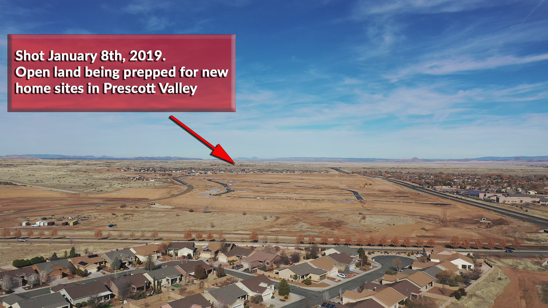
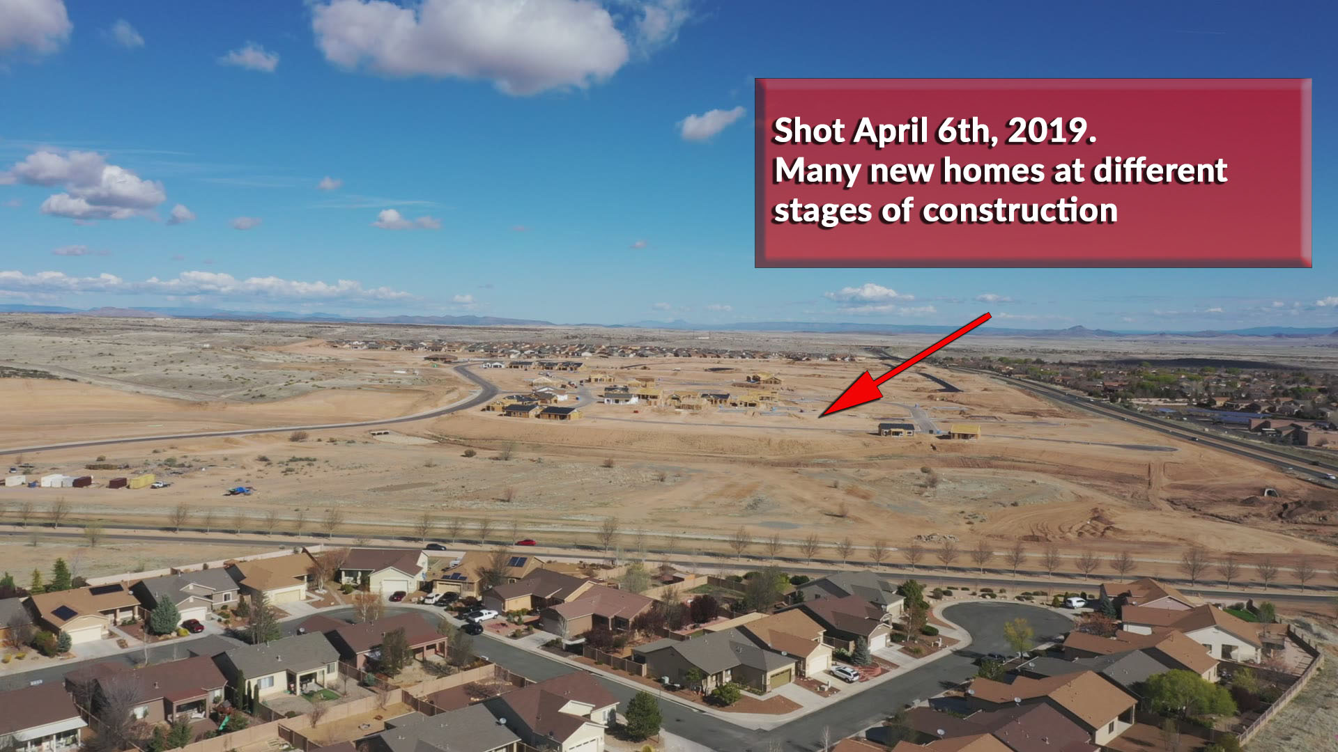
The image above shows part of the new construction that is ongoing in Prescott Valley, AZ. You can see the empty land shot in January of 2019, and the same site in April of 2019 filling in quite nicely. You can drag the slider back and forth on the image above to see the changes easily.
From Open Land To Homes On The Ground
In the span of 3 months you can see some major changes at the new Granville Homes expansion. What was an open parcel of land has become the center for new home construction activity in Prescott Valley. Looking at the images left side of this page you can see the initial empty build site in January, and then slide across to an image updated April of 2019. From empty land to new homes at many different stages of the construction progress all in one simple image comparison.
Construction sites can be monitored in a variety of ways:
- Simple still image time lapses: Every day, every week, or every month images can be shot from a pre-selected location to show progress over time.
- Simple video time lapses: Like the still images, a flight path can be created that is flown over the same exact coordinates. Each flight video can demonstrate build progress.
- 2D & 3D Model generation: Pre-selected flight paths for Orthomosaic, Digital Elevation, and other 3D modeling can be generated and flown on a regular basis to compare build progress over time as well.
- 3D Point Clouds: Pre-programmed flights can also collect point cloud data for your survey engineers, architectural staff, and CAD operators.
Save Money & Time
You can't always be on the job site overseeing every aspect of your project. While there are boots on the ground ensuring the work gets done and reporting on progress, pictures are still worth a thousand words. And video may be worth even more!
Having daily, weekly, or monthly drone progress updates will keep principals filled in on where a project is at in a way that's never been available before. Issues can be identified via a laptop or tablet screen, and action can be taken.
You don't have to physically be on the job site on a daily basis if you are getting regular progression reports.
Additionally, project backers and investors can also be provided updated progression reports, allowing them a view into the project without having to physically visit the build sites.
A Simple 3D Site Model Demo
The model featured below was created with Ground Station Pro, Agisoft's Metashape, and Sketchfab.com. This model is an incredibly simplified 3D Model. A single 360 degree orbit of the house sites taking under 3 minutes in time to capture. 71 feet above ground level, with a radius of 185 feet. A total of 83 images were captured to create a simple low resolution model of the two homes.
Visualize your projects in a whole new way
The Digital Elevation Model (DEM) and Orthomosaic Model shown below offer unique perspective for your construction site. You can view the layout of your latest community from above, and also get clear visual cues for things such as drainage throughout the project area. This is only one example of many when it comes to modeling your construction sites.
The slider bar in the center of the image can be dragged back an forth between Orthomosaic and DEM. Give it a try!