
MacRae Ranch Project
MacRae Ranch Project
This page is being developed by AZ Drone and RLC Design Services for MacRae Ranch.
This page will be developed over time as the ranch project progresses. We'll be documenting the growth and changes at the ranch location. Video progression, still photography time lapses, and orthomosaic model time lapses will be employed in order to share the changes occurring on the property. Also we've included a few "fun" extras that we thought you might enjoy!
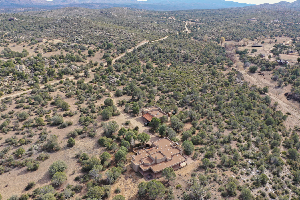
MacRae Ranch imaged November 9th, 2019


Still Image Time Lapse
This section will be updated monthly with select images showing the progress of the changes at the ranch over time. At present (November 10th 2019) we've added some place holder images.
We'll review shot angles with MacRae Ranch and get a set of preferred images to display from month to month.
Updated 11/10/19
Video Progression
As development progresses at the Ranch we'll be collecting video footage each month. That video footage will be used to produce a "time lapse" video of the updates to the property.
At present we've got a place holder video up of our initial test flight at the ranch.
Updated 11/10/2019
360 Panorama
A simple 360 degree panorama demonstration. Since we're just laying the page out I thought it would be appropriate to include another interesting way to view the ranch property.
In the bottom right corner of the panorama viewer you'll find an icon to make the 360 pano full screen. For each of the property updates we'd be happy to include a 360 panorama. We can pick the locations as the development work progresses. These would work well with completed areas for final property display.
Updated 11/10/2019
3D Property Model
While setting up flight paths and an initial 2D Orthomosaic model of the property, I decided to test out how well a 3D model would be generated from data collected for the 2D model.
This is only a roughed out 3D model. I've included it to demonstrate how a model like this can give the entire property view. For our official first and last orthomosaic 2D models we could do a model like this as well with the new structures and cleared areas alike. Just thought you might find the concept interesting.
This model is best viewed on a laptop or desktop computer. While it can be viewed on a smart phone or tablet, navigation is a little difficult on touch devices. You can also display full screen by clicking the arrows in the bottom right corner of the model.
Updated 11/10/2019